AIRMETs (WAs) are advisories of significant weather phenomena but describe conditions at intensities lower than those which require the issuance of SIGMETs. AIRMETs are intended for dissemination to all pilots in the preflight and en route phase of flight to enhance safety.
AIRMET偑敪椷偝傟傞偺偼婋尟側婥徾尰徾偑敪惗偡傞帪偱偡偑丄SIGMET偺婎弨傛傝傕娚傗偐偱偡丅AIRMET偺栚揑偼旘峴弨旛乮Preflight乯傪峴偭偰偄傞憖廲巑傗旘峴拞偺峲嬻婡偵婋尟側揤岓忣曬傪揱偊偰僼儔僀僩偺埨慡惈傪崅傔傞暔偱偡丅
SIGMET偲偲偺堘偄偼丄SIGMET偑Severe儗儀儖偱丄AIRMET偑Moderate儗儀儖 偲 IFR偱偡丅
偳偪傜傕婋尟偱偡偑丄
SIGMET偺曽偑婋尟惈偑崅偄偲妎偊偰偍偄偰壓偝偄丅
There are three AIRMETs: Sierra, Tango, and Zulu. After the first issuance each day, scheduled or unscheduled bulletins are numbered sequentially for easier identification.
AIRMET偵偼俁庬椶偑桳偭偰乽Seirra, Tango, Zulu乿偲嬫暿偝傟偰偄傑偡丅偦偟偰暘傝傗偡偄條偵丄岅旜偵弴斣捠傝偵悢帤偑晅偗傜傟偰偄傑偡丅
- AIRMET Sierra describes IFR conditions and/or extensive mountain obscurations.
丂丂
乽俽乿偼寁婍旘峴忬懺傗嶳妜抧懷偑塤偵暍傢傟偰傞忬懺丅
- AIRMET Tango describes moderate turbulence, sustained surface winds of 30 knots or greater, and/or nonconvective low-level wind shear.
丂丂
乽俿乿偼
棎婥棳丄抧忋晽俁侽僲僢僩埲忋丄偦偟偰掅崅搙僂僀儞僪僔僃傾乮愊棎塤娭楢傪彍偔乯
- AIRMET Zulu describes moderate icing and provides freezing level heights.
丂丂
乽倅乿偼Moderate Icing (拝昘乯 偲 婥壏偑侽搙偵側傞崅搙丄Freezing Level丅
- AIRMET Sierra Tango, Zulu偼昿斏偵帹偵偡傞偺偱妎偊偰偍偄偨曽偑椙偄偱偟傚偆丅
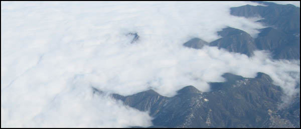
Mountain Obscurations. AIRMET Sierra偑弌傞偐側丠嶳偺懁柺偵塤偑徴撍丅丂嵍懁偼IFR偺條偱偡丅
found on the Aviation Weather Center webpage at http://aviationweather.gov, are graphical forecasts of en-route weather hazards valid at discrete times no more than 3 hours apart for a period of up to 12 hours into the future
恾宍幃偵側偭偨AIRMET偱AWC偺僒僀僩偱墈棗偡傞帠偑壜擻偱偡丅丂撪梕偼捠忢偺AIRMET偲傎傏摨偠偱偡丅
- Instrument flight rule conditions (ceiling < 1000' and/or surface visibility <3 miles)
- Mountain obscuration
- Icing
- Freezing level
- Turbulence
- Low level wind shear (LLWS)
- Strong surface winds
G-AIRMETs provide a higher forecast resolution than text AIRMET products. Since G-AIRMETs and text AIRMETs are created from the same forecast 乬production乭 process, there exists perfect consistency between the two. Using the two together will provide clarity of the area impacted by the weather hazard and improve situational awareness and decision making.
G-AIRMET偼恾偱昞偝傟偰偄傞偺偱丄棟夝偟傗偡偔側偭偰偄傑偡丅丂捠忢偺僥僉僗僩偺AIRMET偲摨偠曽朄偱嶌傜傟偰偄傑偡偺偱丄椉曽偲傕摨偠撪梕偱偡丅丂椉曽傪巊偆帠偱丄傛傝棟夝偑崅傑傝傑偡丅
It should be taken into consideration that the hazardous weather starts immediately after the 00 hour forecast unless there is a defined initiation or ending time for the hazardous weather. The same would apply after the 03 hour forecast. The user should assume the hazardous weather condition is occurring between the snap shots unless informed otherwise. For example, if a 00 hour forecast shows no hazard, a 03 hour forecast shows the presence of hazardous weather, and a 06 hour forecast shows no hazard, the user should assume the hazard exists from the 0001 hour to the 0559 hour time period.
拲堄丅丂00Z丄03Z, 06Z偲俁帪娫枅偺揤岓傪昞帵偟傑偡丅拲堄揰偼偦傟傜偺梊曬偼偦偺帪崗偩偗偱偡丅丂椺偊偽12Z偺応崌偱偟偨傜丄12:00Z僺僢僞儕偺揤岓梊曬偱偡偑丄11:59Z傑偱丂偲12:01Z埲崀偺帠偼娷傑傟偰偄傑偣傫丅丂
椺偊偽丗 00Z偲06Z偵埆揤岓偑柍偔偰丄03Z偵埆揤岓偑梊應偝傟偰偄傞偲偡傞偲丄偦偺埆揤岓偺壜擻惈偼00丗01Z偐傜05丗59Z傑偱偲俆帪娫俆俉暘娫乮栺俇帪娫乯偺壜擻惈傕偁傝傑偡丅乮媡偵侾暘娫偩偗傕斲掕偼弌棃傑偣傫丅乯丂傑偁丄嵶偐偄嬫愗傝偑巜掕偝傟偰側偄偺偑栤戣側偺偱偟傚偆丅丂幚嵺偼丄偦偙傑偱尩偟偔帪娫愝掕傪偟偰傞偲偼峫偊擄偄偱偡丅丂偱傕丄尗柧側恖偼嵟埆偺働乕僗傕峫偊偰偍偔傋偒偱偟傚偆丅丂
師傊
SIGMET : AIRMET : Severe Weather Watch : Center Weather Advisory : intro
丂